

POIs that surface on their own
An empty planner is intimidating. A planner that already populates the corridor — with everything you don't like removable — is a conversation.
If you ask someone to plan a camper trip from scratch, they don’t plan. They stare at the map like at a blank page. The product has to make the first move.
The context
A generic planner’s default state is empty. A huge map, an “add destination” button, and you — who don’t know what sits 30 km past the next fuel stop. Filling that UI takes prior research. Prior research is exactly what people don’t do before they hit the road.
The opposite extreme is too much: a planner that dumps 500 POIs onto the corridor. You have 500 dots. You still don’t plan.
The decision
POIs suggested automatically along the corridor of the route, not the region. Chosen by:
- Corridor, not region. Driving Barcelona to Toulouse, I don’t want to see POIs in the city of Girona — the route doesn’t go there.
- Cap of 5–8 per day. Not 500. You dismiss the ones you don’t like with a click; dismissed ones never come back.
- Shared cache at country/region level. If I’ve already asked about central Catalonia, the next user doesn’t ask again.
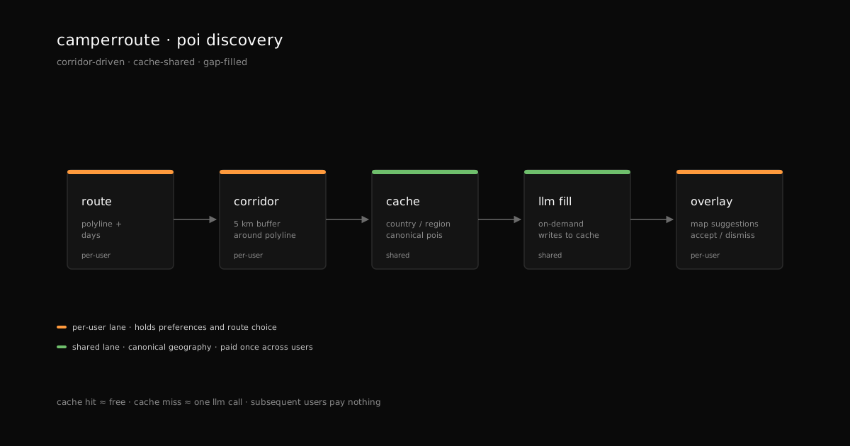
Why a shared cache and not per-user. Geographic knowledge is public. The preference you express over it is private. Splitting the two layers means the LLM cost is paid once per country (not per user), but your route — which POIs you like, which you dismiss — is never shared. The cache never contains anyone; only places.
What it’s not
To be explicit:
- Not a chatbot. There’s no text input where you ask “what’s in Aragon”. POIs show up in the panel; you accept or remove. The conversation is visual, not textual.
- Not autopilot. It doesn’t generate a whole route; it generates candidates for a route the user has already drawn. The final decision is yours.
- Not social recommendation. These aren’t POIs “rated by other users” or “trending”. They’re measured POIs: they exist, they have verifiable coordinates, they fit the corridor.
What’s next
Next post: once you have POIs and a drawn route, what happens when you actually arrive somewhere? How does the system know you got there without you doing anything, and without leaving behind a company that knows where you slept every night?